Susan Chamberlin (February 9, 2018)
It is still difficult to comprehend the terrible loss of lives, homes, gardens, property, businesses, wildlife, and the cultural landscape in Montecito that occurred in the early hours of January 9, 2018 as “debris flows” triggered by a 200-year storm event drenching the Thomas Fire burn area tore apart families and the community. This disaster is now known as the Montecito Mudslides.
The cultural and natural landscapes were ravaged. Creek beds were reconfigured by flash floods and denuded in places as their riparian trees and vegetation were carried downstream along with thousands of tons of mud, ash, sandstone boulders (some bigger than SUVs), entire buildings, automobiles, and telephone poles to be deposited as debris in piles up to 20 feet high and 40 feet wide. Many of the trees and hedges that are a distinguishing feature of Montecito (1) are now gone including ancient coast live oak trees (Quercus agrifolia).
The cultural landscape originated following the Chumash Native American Indians because few, if any, traces of them remain. El Montecito was primarily settled by Presidio soldiers on Mexican land grants. Most lived near Montecito Creek, which flowed year-round before Yankee ingenuity privatized its water. Still called “Spanish Town,” the area of modest houses around East Valley Road and Parra Grande Lane (named for the big grapevine that Maria Marcelina Feliz planted in the 1870s) was hit hard. The Montecito Creek watercourse overall (which combines Cold Springs and Hot Springs Creeks) was where many homes and stone bridges were destroyed or damaged and where 16 of the 21 victims lost their lives. (Two remain missing at this writing.) Other entire neighborhoods were decimated along Romero and San Ysidro Creeks.
On the banks of San Ysidro Creek, the San Ysidro Ranch dates back to about 1825. It is advertised as Forbes magazine’s “#1 Favorite Leisure Hotel Anywhere in the World.” Once known for its oranges and later known as the resort where the Kennedys honeymooned, it is not clear if the Stonehouse Restaurant and Plow & Angel (formerly the orange packing house) or how many of its cottages were damaged or destroyed. The citrus grove, the chef’s garden, and other lovely gardens on the grounds are gone.(2)
Many Montecito gardens were created before the Depression during the Golden Age of American Gardens. Casa del Herrero, a National Historic Landmark cultural landscape, “weathered the storm” wrote Jessica Tade, its Executive Director, in an email of 1-12-18. World-famous Lotusland “is fine” with only some paths “washed out” according to a letter to members from CEO Gwen Stauffer. I heard through a friend that Val Verde, Lockwood de Forest’s masterpiece of landscape architecture, lost most of the landscape elements, a cottage, and rare old trees on the level adjacent to Montecito Creek. The formal reflecting pool (also known as the koi pond) below the steps to the house is damaged and filled with mud. He is certain that across the creek at El Fureidis (Betram Goodhue, 1903) the pavilion at the terminus of the iconic water feature was swept away along with plantings. Little altered over the years, Sotto il Monte (originally called La Toscana, A.E. Hanson, 1929) was spared. I do not know the fate of other significant gardens from the Golden Age. Casa Dorinda was one of them before it became a retirement community. Much of the property is said to be okay, although the entrance was wiped out. Ironically the 100-year-old historic, stone bridge to Casa Dorinda (designed by Carleton M. Winslow) survived the debris flows but the new bridge to replace it for code compliance did not.(3) Riven Rock, the former McCormick estate (c. 1897, Warren H. Manning with Dr. F. Franceschi) was subdivided into 34 parcels around1949. Many landscape elements remained until January when much of Riven Rock and at least one stone bridge was reportedly destroyed.
It will take a long time to survey damage to all the historic houses and gardens in Montecito, not to mention numerous contemporary gardens of note. I hope they and their owners are safe.
1. David F. Myrick, Montecito and Santa Barbara, Volume I: Pentrex Media Group, 1988, page 9 is the source of the idea about Montecito’s distinguishing features; this and Myrick’s Volume II (Trans-Anglo Books, 1991) are the best references for the history of Montecito. Information on the Montecito Mudslides is from friends, news reports (many sources), and maps posted online by the Santa Barbara Independent, the County of Santa Barbara, and KEYT News.
2. Bob Hazard, “Fire and Flood, Mud and Debris,” Montecito Journal, vol. 24, no. 3 (18-25 January 2018), 33. Hazard, 28.
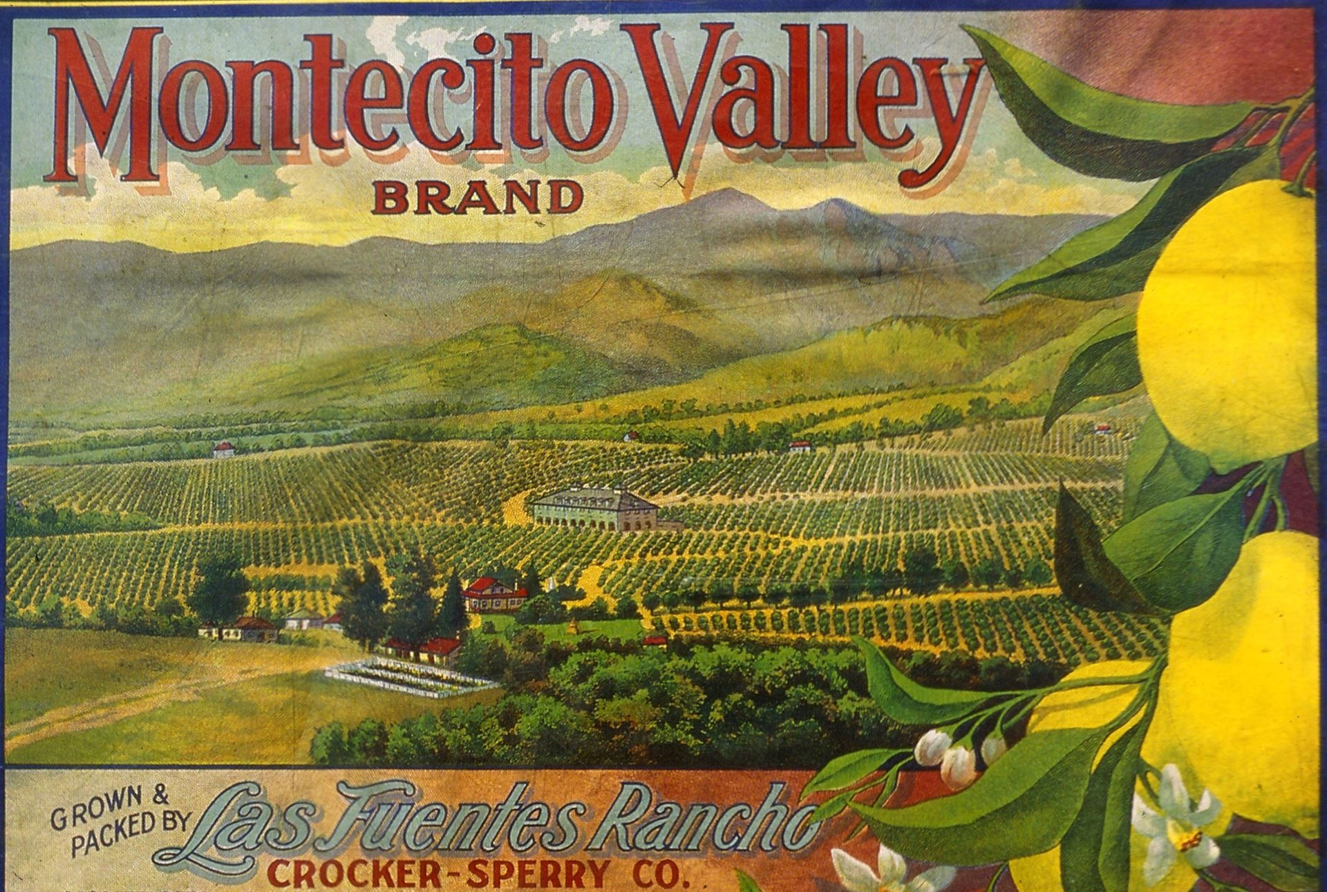
The old lemon box label at the head of this update shows the Crocker-Sperry Company’s Las Fuentes Rancho orchards and the mountains behind Montecito, California before the landscape was transformed into the modern landscape we knew prior to January 9, 2018. East Valley Road (Hwy 192) is marked by rows of eucalyptus trees behind the Rancho. In 1967 the Rancho became the Birnam Wood Golf Club development (Thomas D. Church, landscape architect, Robert Trent Jones, golf course designer.) Early on January 9, 2018 flash floods and mudslides called “debris flows” originating in the Thomas Fire burn area descended on Montecito and transformed its landscape in a matter of minutes. In the aftermath of the debris flows, helicopters landed on the Birnam Wood fairways to transport victims to the hospital or to shelters.